The Mediterranean was the highway of the ancient world — the sea around which Egypt, Phoenicia, Greece, Carthage and Rome all grew, and across which goods, peoples and ideas moved. To control its waters and its coasts was to command the wealth and the connections of the classical world.
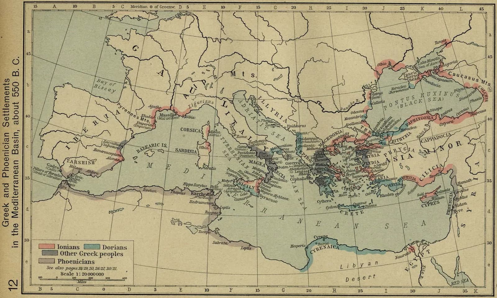
This map shows the great age of colonization (c. 550 BCE), when the Greeks and the Phoenicians planted settlements along the Mediterranean and Black Sea coasts — the Greeks in Sicily, southern Italy (Magna Graecia), Gaul and the Black Sea; the Phoenicians, from Tyre, founding Carthage and the trading posts of the west. The rivalry of these colonial worlds would shape the wars of the centuries that followed.
Key locations
- Carthage — The great Phoenician colony in North Africa, later Rome's rival.
- Magna Graecia — The Greek cities of Sicily and southern Italy.
- Massalia — The Greek colony at modern Marseille.
- The Aegean — The Greek heartland of islands and coasts.
- Tyre — The Phoenician mother-city of the western colonies.