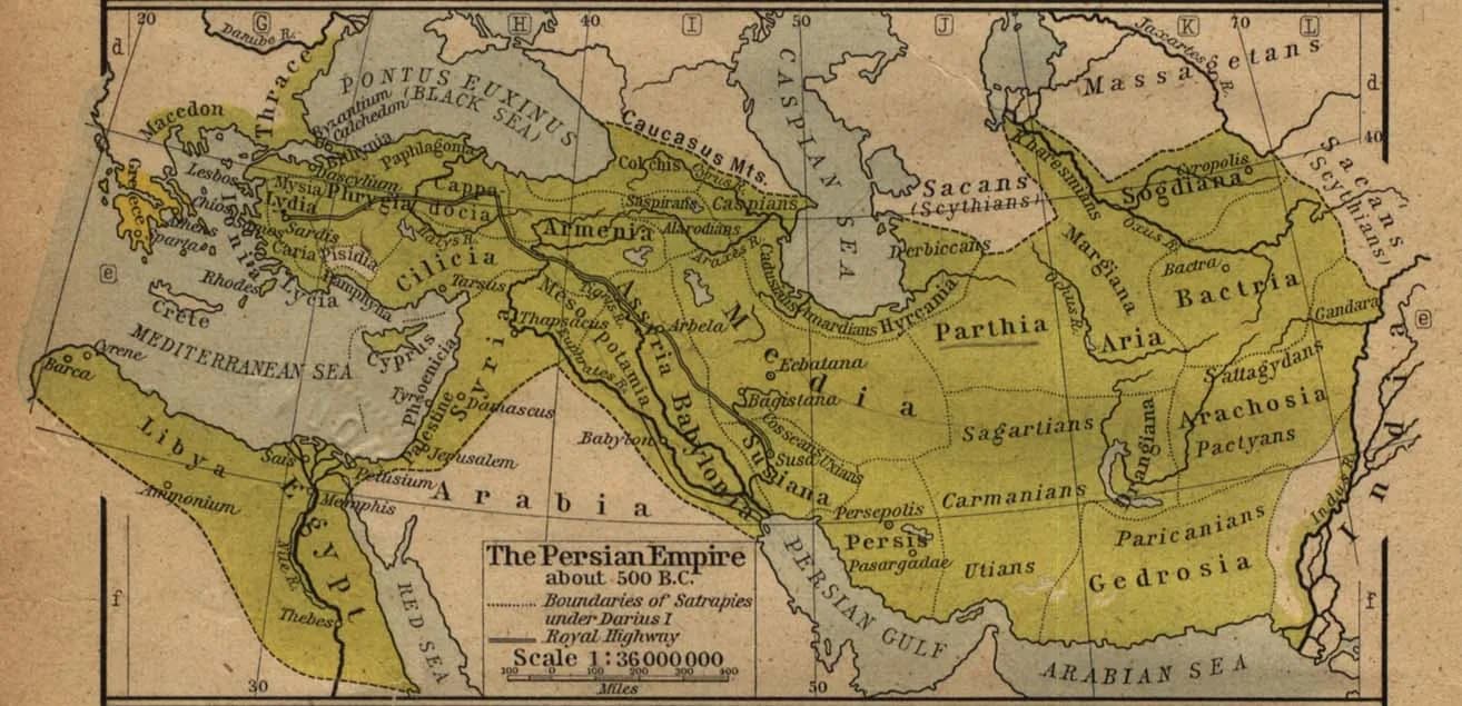
The Achaemenid Empire, founded by Cyrus and organized by Darius, was the largest the world had yet seen — stretching from the Aegean coast and Egypt in the west to the Indus valley in the east, embracing dozens of peoples, languages and traditions.
It was governed through satrapies — provinces under royal governors — bound to the centre by the royal roads, a standardized coinage, and a policy of tolerant accommodation that left subject peoples their own laws, gods and elites. This was the first durable solution to the problem of governing a multi-ethnic world, and the model Alexander and his successors inherited.
Key locations
- Persepolis — The ceremonial capital, with the great Apadana.
- Susa — The administrative capital and terminus of the Royal Road.
- Babylon — The greatest city of the empire, taken by Cyrus in 539 BCE.
- Sardis — The western satrapal capital, near the Greek world.
- The Royal Road — The relay road linking Susa to Sardis across the empire.