The Roman Republic began as a single city-state in central Italy and, over centuries, brought the whole Italian peninsula under its control — first the neighbouring Latins and Etruscans, then the Samnites and the Greek cities of the south — binding them through a flexible system of alliances and colonies.
This Italian base, with its reserves of manpower and its network of military roads, was the foundation of Roman power. From it the Republic went on, in the Punic Wars, to defeat Carthage and master the western Mediterranean, and then the Hellenistic East — an expansion that brought the wealth and the armies that would eventually destroy the Republic itself.
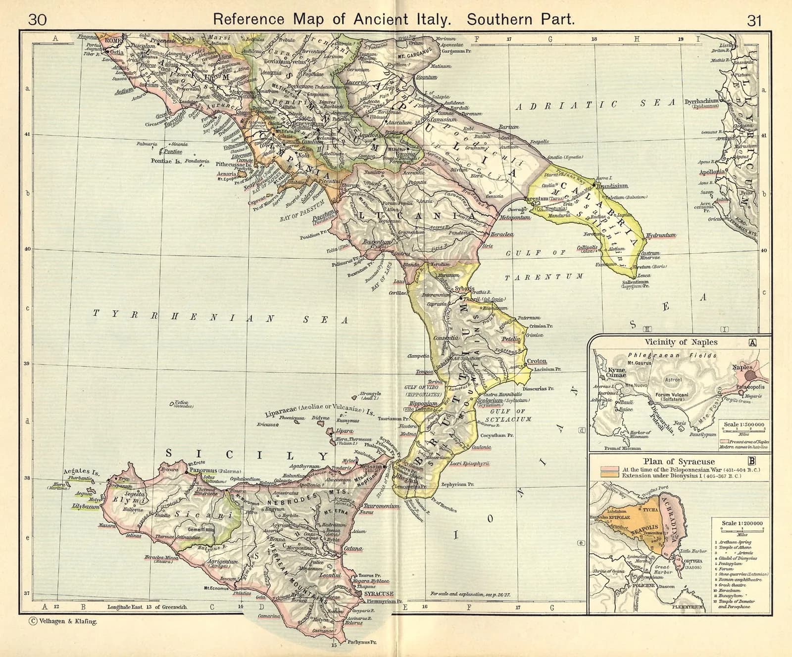
Key locations
- Rome — The city on the Tiber from which the Republic grew.
- Latium — The home region of the Latins, Rome's first sphere.
- Capua & Campania — The rich region of the south, contested in the Punic Wars.
- The Greek cities — Tarentum and others in the south (Magna Graecia).
- Cannae — In Apulia, site of Hannibal's great victory of 216 BCE.