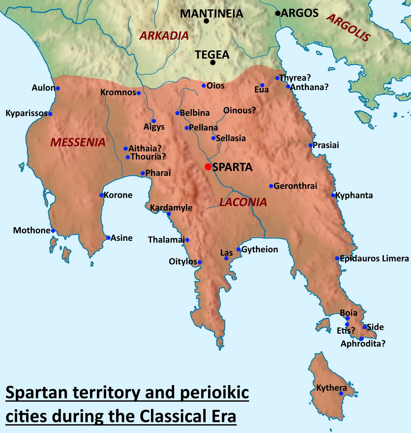
Sparta lay in Laconia, in the southern Peloponnese, in a fertile valley walled by mountains. Uniquely among Greek cities, it was unwalled — its citizen army was its defence — and it controlled an unusually large territory by conquest rather than colonization.
The key to Spartan power was Messenia, the rich region to the west conquered in the archaic period and held as a subject population of helots, whose agricultural labour freed the Spartiate citizens to be full-time soldiers. When Epaminondas liberated Messenia in 369 BCE, the economic foundation of the whole Spartan system collapsed, and Sparta never recovered.
Key locations
- Sparta — The unwalled city in the Eurotas valley of Laconia.
- Laconia — The Spartan home territory in the south-east Peloponnese.
- Messenia — The conquered region whose helots sustained the Spartan economy.
- Leuctra — In Boeotia, site of the 371 BCE defeat that broke Spartan power.