Ancient Greece was not a unified country but a world of hundreds of independent city-states (poleis), separated by mountains and the sea. This geography shaped its politics: the rugged terrain favoured small, self-governing communities and frustrated unification, producing both the creativity and the fragmentation of the Greek world.
The sea was the great connector. Greek civilization extended far beyond the mainland — to the Aegean islands, the coast of Asia Minor (Ionia), and colonies across the Mediterranean and Black Sea. The two leading powers, maritime Athens and land-based Sparta, embodied the contrast that the Peloponnesian War would test to destruction.
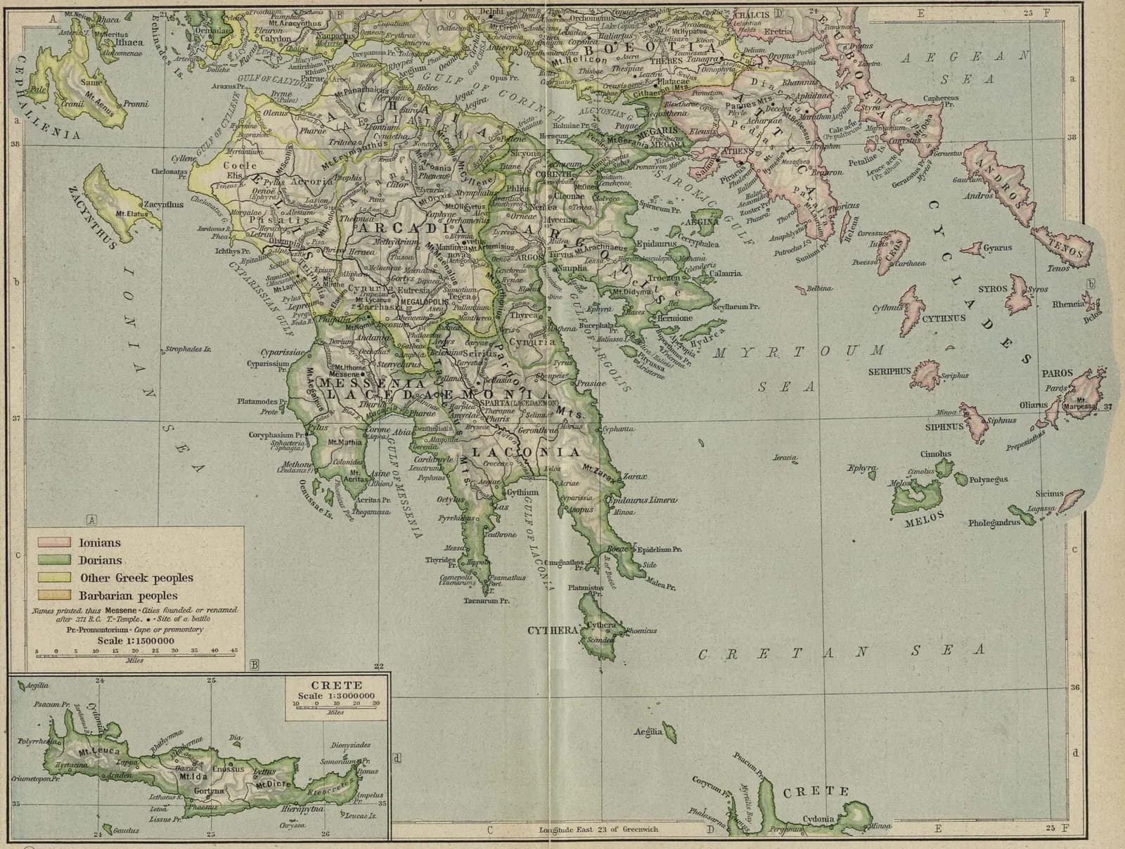
Key locations
- Athens — The leading democracy and naval power, in Attica.
- Sparta — The militarized polity of Laconia, in the Peloponnese.
- Thebes — The chief city of Boeotia; briefly dominant after Leuctra.
- Delphi — The sanctuary of Apollo and the oracle, the religious centre of Greece.
- Ionia — The Greek cities of the Asia Minor coast, often under Persian pressure.